It has been almost four weeks since our last post. Three weeks of that time was spent sailing from island to island throughout the Bahamas, mostly without internet access. We chose a less traveled route and visited several of the more remote islands. Everything about our sail through the Bahamas was beautiful and we will definitely return in the fall.
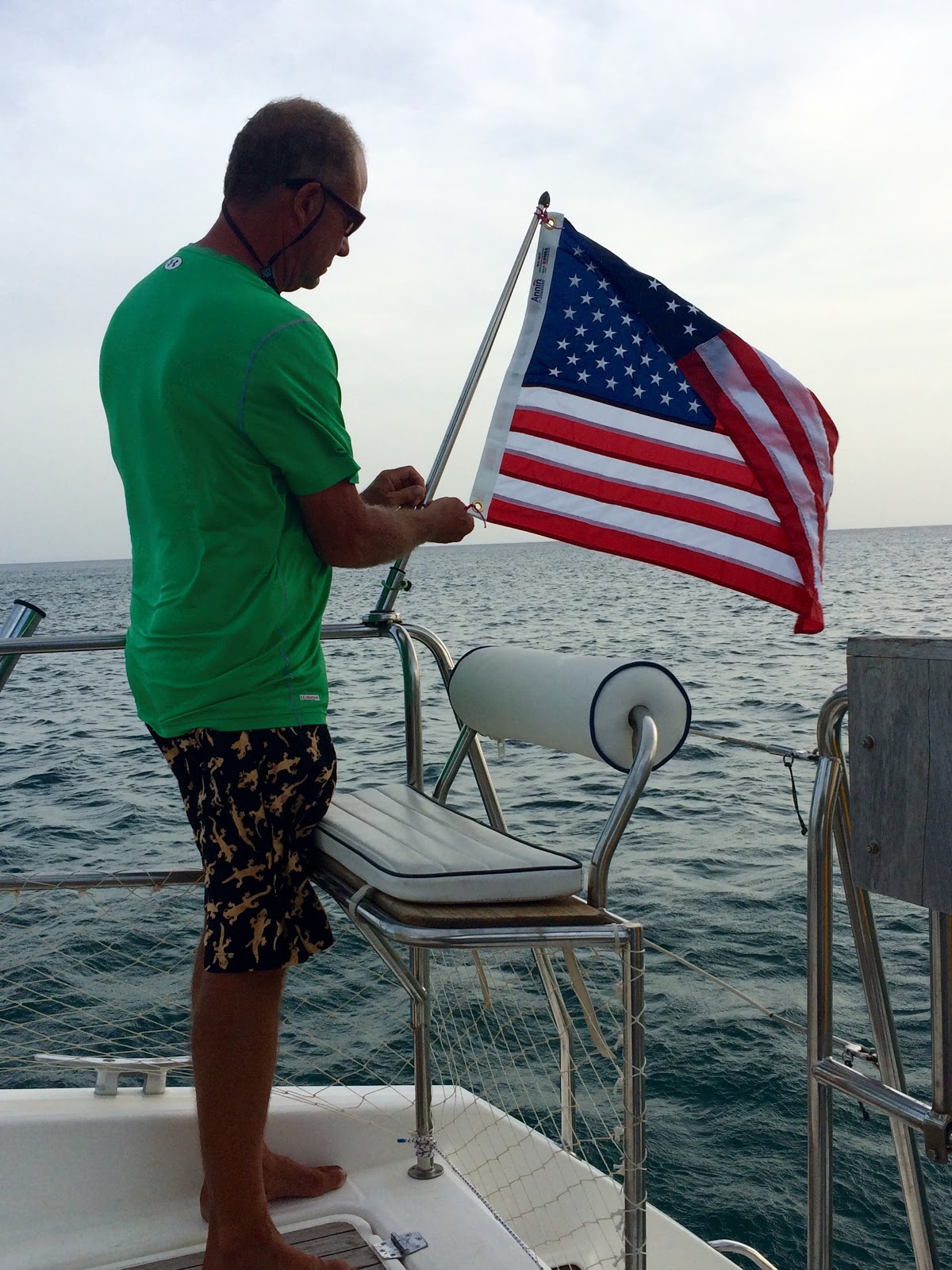
Before leaving West Caicos for Mayaguana, the farthest eastern island in the Bahamas chain, we received confirmation that our boat has finally been documented in the United States and is no longer registered in France. Down came our French flag and up goes our American flag! Bangarang! Woohoo!
 |
| Goodbye French flag |
 |
| Now proudly flying our American flag |
 |
| Anchored off West Caicos, staging to cross over to the Bahamas |
 |
| Farewell, West Caicos! |
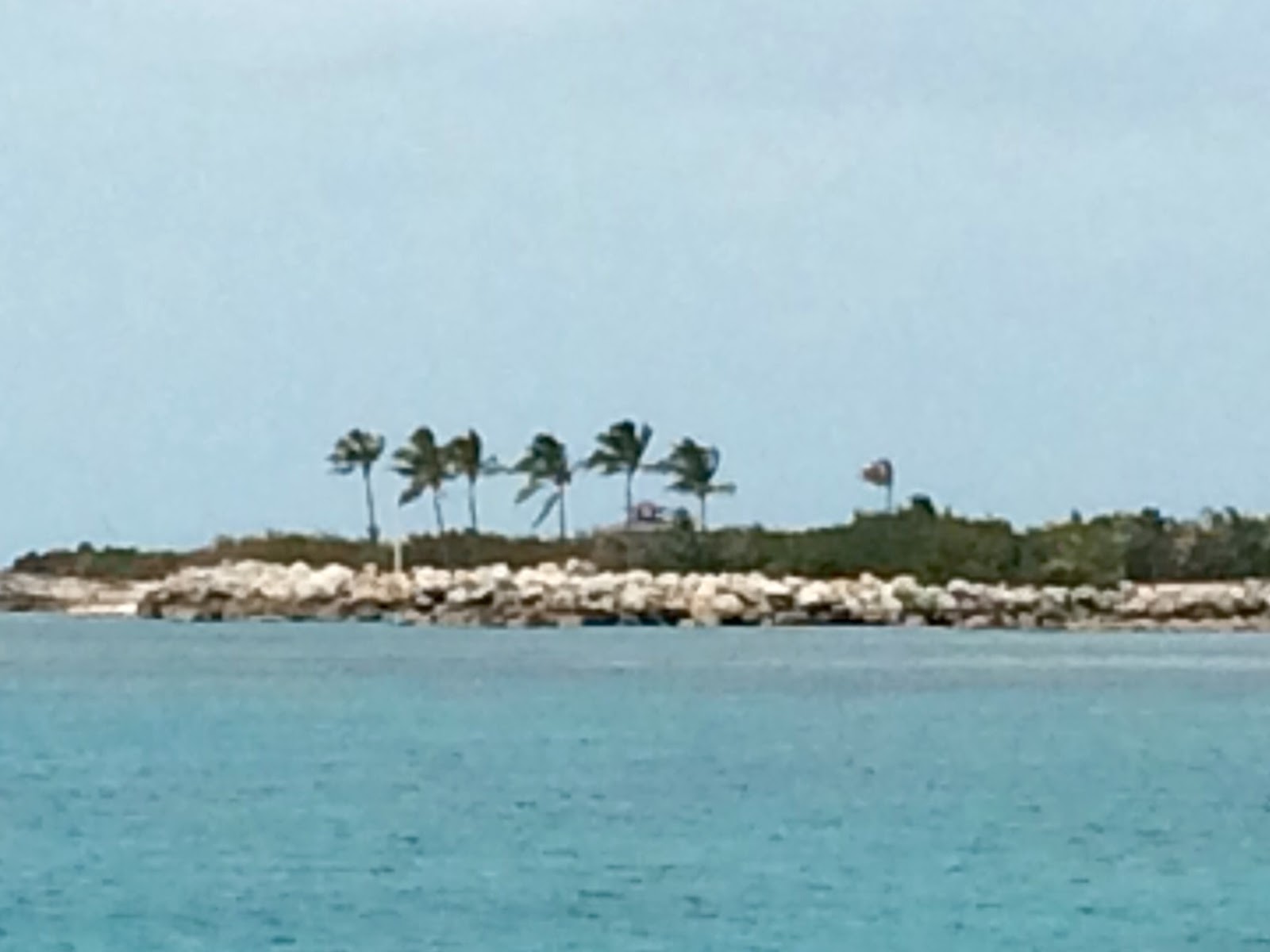
On June 16, we sailed 60 miles to Mayaguana. The island is about 6 miles by 24 miles at its widest points and has approximately 300 inhabitants. The Bahamas's mail boat comes once weekly to drop off and pick up mail! It's the Bahamas' most isolated island and is considered the halfway point between Puerto Rico and south Florida. Abraham's Bay, one of three settlements, is a quick-stop port of entry for sailors entering or leaving the Bahamas. The terrain is woody with fertile soil good for farming. Mayaguana is surrounded by coral reefs and shipwrecks. Home to several government nature reserves, it's an eco-tourist destination for its untouched natural habitat. There are 118 species of birds on the island in addition to sea turtles and iguanas. It is also home to the Bahamian Hutia, a plump brown rabbit-size nocturnal rodent, extinct until the 1960s and a protected species today. We spent one night anchored in Abraham's Bay and marveled at the sunset off our stern. After clearing Customs the next morning, Kent and I began our sail through the Bahamas chain from east to west.
 |
| Sunset from our stern at anchor in Abraham's Bay |
 |
| Our courtesy flag for the Bahamas |
 |
| Visited by a stingray, one of several that day |
 |
| After clearing Customs, we raise the Bahamian courtesy flag |
 |
| Dinghy Captain taking Trooper to shore |
Next crossing: a 55-mile sail to Samana Cay. It had been very foggy the night before, but the fog had lifted by morning. We still had a stingray enjoying the shade under our boat as we ate breakfast.
 |
| A passing storm cloud left a rainbow in its wake |
 |
| Samana Cay on the horizon |
Ten miles long and two miles wide, Samana Cay is the largest now uninhabited island in the Bahamas. Some researchers believe that it is the location of Columbus' first landfall in the Americas, on October 12, 1492. It is surrounded by coral reefs.
 |
Watching for coral heads (the dark spots appearing
near the surface of the water) as we anchor at Samana Cay |
The next day, we headed for Rum Cay, an 80-mile sail from Samana Cay. Expecting a long day, we were up at 6 a.m. and motor-sailing for speed by 7 a.m. Good wind and sunny skies.
 |
| Rum Cay in our sights |
 |
| At anchor in time for the sunset |
 |
| The view off our stern |
 |
| Bright, moonlit night |
 |
| Libations after a long day's sail |
 |
| Too tired for anything fancy. Love our beans, rice, and fresh pineapple supper! |
Rum Cay is known as the "sleeping beauty" because it's considered one of the best-kept secrets of the Bahamas' southern region. Rum Cay is recognized for its historical ruins, coral reefs, miles of pristine beaches, crystal clear turquoise waters, and vibrant marine life. Port Nelson is the only inhabited village on the island. The island residents rely heavily on tourism as their source of income. Because it is a destination for fishermen, snorkelers, and divers, there has been some development and many of the residents are employed by the marinas, resorts and restaurants there.
 |
| Beautiful water at Rum Cay |
 |
| Kent took time out for some fishing |
Our next destination was Conception Island, a short 27 mile sail. We didn't depart Rum Cay until almost 10 a.m. because we slept in. Too tired after getting up at 3 a.m. to close hatches, kill mosquitoes, and fight off the "no see'ums."
Our sail to Conception Island was a bit slow with wind under 10 knots but it was good weather and a lovely day. Conception Island is regarded by many as the most spectacular island in the Bahamas. I believe it is our favorite. It's a tiny uninhabited island, all of 2,100 acres, with pink sand beaches, gorgeous sandstone cliffs, and perfectly clear turquoise water. It's a nesting ground for seabirds and a hatching site for green turtles. The island is truly stunning. All of the following pics were taken during our stay at Conception Island. We will definitely be coming back here!
 |
| Conception Island off our bow |
 |
| Watching for coral heads, as we look for an ideal anchorage |
 |
| Dang those coral heads |
 |
| The long barely touched beach at Conception Island |
 |
| Clear turquoise water with white sand bottom |
 |
| We had three neighbors: a couple of sailboats and a trawler |
 |
| Storm clouds and some hard rain -- felt good after our sail |
 |
| Unbelievably black clouds and vivid pink skies |
 |
| Kent putting the mainsail to bed for the night |
 |
| Not a sound could be heard as the sun went down on the horizon |
 |
| Playing with Trooper on the beach |
 |
| Bird tracks |
 |
| Lush, powdery sand |
 |
| Bangarang! |
 |
| The water is stunningly clear |
 |
| That's me taking pictures |
 |
| Setting the dinghy anchor |
 |
We rely on our dinghy every day to get to and from shore.
Ours is a little worn and has a couple of patches,
so we are considering what dinghy we will buy soon |
 |
| Clear water right down to the clean, soft sand bottom. No plants or rocks. |
We hated to leave Conception Island, but the next day, we were off to Hawk's Nest Marina on Cat Island. The island is in the central region of the Bahamas and there are about 1,200 residents. It is home to the highest point, Mount Alvernia, or Como Hill, at a height of 206 feet. At the top lies a monastery called The Hermitage and the ruins of Armbrister Plantation. I'd seen pictures of the monastery and ruins, and really wanted to explore them, but that will have to wait for our trip back in the fall. The island is also known for the fact the Manuel Noriega had a house there (at the mouth of the harbor) and built a runway for his drug trade. He was a military dictator in Panama in the 1980s and captured, tried, and sentenced by the U.S. for drug trafficking, racketeering, and money laundering in the early 1990s. He served his sentence and I believe returned to Panama in 2011. Anyway, his house is in shambles now. Oddly, the runway is barely a paved "road" and cars very casually cross it as they travel the island, even though the runway is still used. The drivers just look both ways and proceed across! Despite the fact that we didn't explore the island much, it was a nice treat to celebrate Fathers Day at the nearby resort.
 |
| Watching the cloud system... |
 |
| Entering the canal on Cat Island |
 |
| Made it to the gas dock at Hawk's Nest Marina before the storm |
 |
Trooper cruising the deck watching for the stingrays
and sharks following us in the channel... |
 |
| Those are giant moths Kent is trying to catch. Eeeww. |
 |
| At the bar in the Hawk's Nest Resort nearby the marina... |
 |
| My date for the evening |
 |
Kenny Chesney has his name on a rum here on Cat Island.
The bartender let us try some. We don't recommend it! |
 |
Artwork in the dining room.
We treated ourselves to an excellent local fish dinner at the resort. |
 |
Guests at the marina (us) were invited to enjoy a swim in the resort pool.
It looked inviting if only because we were the only guests there that evening! |
 |
| Happy Fathers Day, honey! |
 |
It is summer and off-season here.
We had the whole dining room to ourselves! |
 |
Yes, believe it or not, that is a real telephone booth
behind our boat in the marina! Not sure what that's about. |
 |
Caution is needed as it is very shallow in some places.
We are lucky that Bangarang only draws 3 feet 9 inches. |
Our continued sail through the Bahamas took us 42 miles to the island of Little San Salvador. The skies were very cloudy, which was kind of a relief from the usual hot sun. We sighted a storm system in the last 20 miles of our trip and the winds kicked up around us. We took down the jib, turned on our engines, and managed to avoid the rainstorm. We anchored safely in Half Moon Bay at 3 p.m.
 |
As we approached Little San Salvador,
we noticed a cruise ship anchored off the island... |
 |
| It was a BIG Carnival cruise ship |
 |
We anchored in 6 feet of clear turquoise water just like a
swimming pool. No coral heads or plant life. Just a clean
sandy bottom. |
 |
| Yes, if you look carefully, those are horses being ridden on the beach! |
It turned out that Little San Salvador is a private island owned by the Carnival cruise line. No wonder there was little mention of the island in our chart books! Carnival developed the island into an adventure park with a water park, a children's pirate ship, cabanas, restaurant, bar, horses and stable, etc. The island is used as a stop on their cruises in the Bahamas, ferrying cruise passengers to and from the island from the ship.
 |
Nobody bothered us or asked us to leave as we
remained anchored on the lee side of the island |
 |
In late afternoon, the cruise ship departed with all its passengers
and we were left to enjoy the view by ourselves |
 |
| Swimming in the glistening water |
 |
| Is that a shark? Uh, no, just Kent snorkeling |
We enjoyed steak on the grill off our stern, a couple of rum drinks, and a the Latin playlist music I collected as we sailed through Puerto Rico and the Dominican Republic. As I recall, there was even a little dancing in our salon with my date. Hot-ayiyi!
The next day, we sailed off to Governors Harbour on the island of Eleuthera. This was a very pleasant 64-mile sail with 15 knot winds and sunny skies. We dropped our sails quickly outside the entrance to Davis Channel at Powell Point because of shallows and coral heads. We watched the charts closely in 6 foot depths and anchored safely in the harbor at 5 p.m.
 |
| We anchored right off the public swimming beach in Governors Harbour |
 |
There was evidence of a nice little town on shore and a cruiser
on another catamaran anchored nearby told us that he and his wife
enjoyed three days visiting there. We were only there for the night. |
Next day: off to Egg Island, a 40-mile sail to the north edge of Eleuthera. We motored most of the day. The wind was at our backs it was difficult to steer around all the white softball-sized lobster pot buoys set by the local fishermen. There must have been 50 of them scattered all over our route and there hard to see. At the north end of Eleuthera, we had to cross through Current Island Channel at high-throttle against a strong current (hence the name) and we could only make 5 knots of speed. We also took the 11 foot channel between Little Egg Island and Egg Island because it was faster than going around the other way. Rain clouds approached and we had a nice, cool light rain as we anchored on the southwest side of Egg Island in the late afternoon. Aaahhh.
Egg Island is a tiny uninhabited island with a crescent-shaped beach, surrounded by coral reef. The deepest water is about 6-1/2 feet and the shallow water is very warm.
 |
| Cool cloud formations |
 |
| Fun with knots that afternoon |
 |
| More clouds |
 |
| A hazy light pink sunset |
From Egg Island, we sailed 49 miles to the west side of Sandy Point on Great Abaco Island. We opted not to raise our sails because the wind was 8 knots directly at our backs. We had rain mid-afternoon and a nice cool breeze in late afternoon. Our anchorage was right off the town's shore in about 5 feet of water. The water was clear and the bottom was partially covered with short grasses. We didn't get a chance to go ashore. For some reason, I have no pictures from that day except of the delicious Rum French Toast with jam we had for supper.
 |
| I had no vanilla so I used rum instead. Delicious! |
The next day, we sailed 35 miles to Water Cay (formerly Little Bersus Cay). See my next post to hear about Kent's big fishing adventure!


No comments:
Post a Comment